Wednesday, November 13, 2013

Bignor Roman Villa


Bignor Roman Villa is located in West Susssex, not far from Arundel and Chichester. It was discovered by accident in July 1811, and only three years later (October 1814) the site was turned into a private museum with public access. Since then, the remains of the villa have been covered by several modern buildings to protect them against bad weather.

This ancient Roman villa is the subject of a short, but excellent guidebook published by the Bignor Museum. For some reason the date of publication is not mentioned anywhere. Perhaps it was published around 1995.

In a foreword, Thomas R. Tupper explains how the villa was discovered by one of his ancestors in 1811. The villa is still owned by his family, and by now it has been open to the public for almost two hundred years. About 35,000 people from all over the world visit the villa every year.

The guidebook is written and illustrated by Fred Aldsworth of Chichester. The main text (20 pages) is divided into four parts:

(1) The location of the Villa

(2) Excavations of the Villa

(3) The History of the Villa, which is divided into three phases

(4) A Tour of the Villa, which is divided into several short sections:

** The Ganymede Room
** Geometric mosaics (in room # 6)
** Venus and the Gladiators (in room # 3)

** Winter (a mosaic)
** Dolphin and Signature (a mosaic)
** Four Seasons (a mosaic)

** The North Corridor
** Building Materials
** The Baths

The text is illustrated by numerous maps, drawings, and photos. All illustrations are in colour, except a few old photos which are in black-and-white. All illustrations are helpful and instructive. Here are two examples:

(a) A beautiful reconstruction painting of the fourth-century villa seen from the air (made by Neil Holland) appears on pp. 10-11.

(b) An elegant drawing of the Venus room (made by Richard Smirke in 1812) is placed on the front cover of the guidebook.

At the end of the book there is a list of references (further reading) as well as some practical information about the site and how to get there.

Since 2009 the villa has an official website on the internet where you can find information about current events at the site.

Bignor Roman Villa is an interesting place. It is worth a visit. The guidebook about the site – written by Fred Aldsworth and published by the Bignor Museum - is short, but excellent. Read it before you go. It will help you understand and appreciate what you see. Bring it with you, when you go. It will help you navigate the site, while you are there.

PS. Other Roman villas in England are also worth a visit, for instance Lullingstone Roman Villa in Kent and Chedworth Roman Villa in the Cotswolds.

* * *


 Fred Aldsworth, 
Bignor Roman Villa,
The official guide book, published ca. 1995, 20 pages


* * *


Tuesday, November 12, 2013

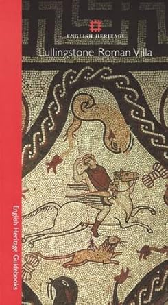
Lullingstone Roman Villa


Lullingstone Roman Villa is located in Kent, close to the River Darent. The villa was discovered in 1939. Excavations began in 1949 and lasted until 1961. Today the remains of the villa are covered by a modern building to protect them against bad weather, and the site is a museum which is open to the public.

This ancient Roman villa is the subject of a guidebook written by Michael Fulford and published by English Heritage. The book is divided into two parts:

** Part one – “A Tour of the Villa” – is divided into fourteen short sections. Each section presents a room or a part of the villa.

** Part two – “The History of the Villa” – is divided into eight short sections. Archaeologists have identified four phases in the development of the villa, starting with the early villa (AD 75-150) and ending with the Christian villa (AD 350-425).

The text is illustrated by numerous maps, drawings, and photos. All illustrations are in colour, except a few old photos which are in black-and-white. All illustrations are helpful and instructive; in particular some reconstruction drawings which show us what the villa (probably) looked like in antiquity. Two of these drawings give a partial view of the exterior and the interior at the same time; some of the walls are cut away, so you can look inside some of the rooms (pp. 6 and 26).

One of the most striking features of the villa is a huge floor mosaic which covered the dining room as well as the audience chamber. The mosaic is shown several times in the book:

** On page 15 we have a total view of the mosaic. The caption to the picture says:
 
“The magnificent mosaics that adorned the main reception rooms of the house. They depict mythological scenes, with roundels of the seasons, and elaborate geometric borders.”

** On page 28 we have the mosaic in the dining room (a semi-circle). The caption to the picture says:
 
“The abduction of the princess Europe by Jupiter disguised as a bull is shown in the mosaic in the apsed dining room.”

** On page 31 we have the mosaic in the audience chamber (a square). The caption to the picture says:
 
“The mosaic of Bellerophon slaying the Chimera may be a Christian allegory of the triumph of good over evil.”

The ancient villa is also famous because there is some evidence of the early Christian religion in Britain. The evidence is presented in text and illustrations. The illustration on page 10 shows six Christian men who are praying. The caption explains:

“This image of six early Christians praying is a modern reconstruction of the wall painting from the west wall of the house church, or chapel. It has been painstakingly pieced together from the fragments of painted plaster which had fallen into the cult room below.”

Lullingstone Roman Villa is an interesting place. It is worth a visit. The guidebook about the site – written by Michael Fulford and published by English Heritage - is excellent. Read it before you go. It will help you understand and appreciate what you see. Bring it with you, when you go. The maps will help you navigate the site.

PS. Other Roman villas in England are also worth a visit, for instance Bignor Roman Villa in West Sussex and Chedworth Roman Villa in the Cotswolds.

 
* * * 
Michael Fulford,
Lullingstone Roman Villa,
English Heritage, London, 2003, 32 pages
 
* * *
 
A new edition of the guidebook for Lullingstone, written by Pete Wilson,
was published by English Heritage in 2009. Here is the cover:
 
 
* * *


Monday, November 11, 2013

Wroxeter Roman City


Wroxeter Roman City is located in Shropshire, ca. 125 km north of Caerleon Roman Fortress in Wales. In Roman times it was called Viroconium Cornoviorum. This area was the home of the Celtic tribe the Cornovii.

In AD 58 the Roman governor Gajus Svetonius Paullinus established a fortress here which became the base of a Roman legion, Legio XIV Gemina. Eight years later, in AD 66, this legion was transferred out of the province and replaced by the 20th legion, Legio XX Valeria Victrix. In AD 90, when this legion was moved to its new base in Chester, the fort was demolished and the site was turned into the capital of the local tribe.  It is very likely that Emperor Hadrian was here during his visit to Britannia in 122. Eight years later, in AD 130, the forum was dedicated to him. At the time this was the fourth largest town in Roman Britain.

Today most of the ancient town has disappeared. But archaeologists have identified several buildings, and they have uncovered the great bath complex from AD 150.

Here is a brief description of the Roman remains:

A covered exercise hall (a basilica) which measured 20 x 75 meters was located in the north. A part of the wall on the south aisle is still standing. It is known as “The Old Work.”

The main bath halls were located in the south: frigidarium (the cold room), tepidarium (the tepid room), calidarium (the hot room), and praefurnium (the furnace).

The local market (macellum) was located in the south west corner of the site. It was a square enclosed by twelve small shops (tabernae).

Between the market and the bath halls, there was an open air sports area (palaestra) and a swimming pool (piscina).

This ancient site is the subject of an excellent guidebook written by Roger White and published by English Heritage. The book is divided into two parts. The first part presents a tour of the site, including the local museum. The second part presents the history of the site. The book ends with a bibliography and a timeline with two columns: (a) key dates in history and (b) key dates in Wroxeter’s history. The text is illustrated by numerous photos, drawings and maps. All illustrations (except two old photos and two old drawings) are in colour. All illustrations are helpful and instructive.

The photos show the current condition. They show what is visible today. The drawings are modern reconstructions. They show what a particular building (probably) looked like when it was new. The maps give us orientation: there is a map of Roman Britain (England, Wales and Scotland) in the second century AD on page 26, and there is a plan of the site on the inside of the back cover.

The first part of the book – “A Tour of Wroxeter” – is divided into several short sections including the following:

* The Basilica
* The Bath Halls

* The Latrine and the Shops
* The Market Hall

* The Forum
* The Site Museum

In the local museum you can see a short exhibition on the history of the town and some of the objects found on the site. You can also see a cast of a marble plaque with the fine inscription from AD 130 which dedicates the forum to Emperor Hadrian. Today the original is placed in Rowley’s House Museum in Shrewsbury. A picture of the plaque appears on page 24, but the author does not give us the Latin text or an English translation.

Let me make up for this omission. Here is the Latin text:

IMP CAES DIVI TRAIANI PARTHICI FIL DIVI NERVAE NEPOTI

TRAIANO HADRIANO AUG PONTIFICO MAXIMO TRIB POT XIIII

COS III PP CIVITAS CORNOVIORUM

And here is an English translation:

“The council of the Cornovii [erected this monument] to Imperator Caesar Traianus Hadrianus Augustus, the son of the divine Traianus Parthicus, the grandson of the divine Nerva, Pontifex Maximus, holding tribunician power for the 14th time, consul three times, [and] father of the fatherland.”

[Source: Roman Inscriptions of Britain, Vol. I (1965), # 288.]

In Roman times the plaque was placed over the entrance to the forum. The size of the plaque (370 x 123 cm) and the height of the letters (between 14 and 24 cm) made it highly visible to those entering the site.

[Louise Revell makes this important point in her book Roman Imperialism and Local Identities, published in 2008, page 180.]

Wroxeter Roman City is an interesting historical monument. It is worth a visit. Roger White has written an excellent guidebook about it. Read it before you go. It will help you understand and appreciate what you see. Bring it with you when you go. The plan of the site will help you identify each building and each room as you tour the ancient site.

* * *
 
Roger White,
Wroxeter Roman City,
English Heritage, London, 1999, 36 pages
 
* * *
 
A new edition of the guidebook for Wroxeter (48 pages), also written by Roger White,
was published by English Heritage in 2012. Here is the cover:
 
 
 * * *


Sunday, November 10, 2013

Caerleon Roman Fortress


Caerleon Roman Fortress is in the south of Wales, some 20 km northeast of Cardiff. In Roman times it was called Isca, after the river Usk. This area was the home of the Celtic tribe the Silures. At first they fought the Romans, but later they became the most Romanized tribe in Wales.

In AD 74 or 75 the Roman governor Sextus Julius Frontinus built a fortress, which was the base of a Roman legion, Legio II Augusta, until the fourth century. The fortress covered an area of 20 hectares and had the typical shape of a playing card, i.e. a rectangle with round corners. The Romans had standard rules for the orientation of a fortress and for the different buildings inside it, but there was always room for local variations. No two fortresses are exactly alike.

The modern town is built on top of the ancient fortress. Accordingly, it is not so easy for archaeologists to work there. But the outline of the fortress is visible. Several buildings have been identified, and some of them have been uncovered. The foundations of these buildings are visible today.

This ancient site is the subject of an excellent guidebook written by Jeremy Knight and published by Cadw: Welsh Historic Monuments. The book is divided into two parts. The first part presents the history of the site. The second part presents what you can see today. The text is illustrated by a large number of photos, drawings, and maps. All illustrations are in colour. All illustrations are helpful and instructive.

The photos show the current situation. They show what is visible today. The drawings are modern reconstructions. They show what a particular building (probably) looked like when it was new. The maps give us orientation: we have the Roman Empire on page 7, and Wales on page 10. A fold out map printed on the inside of the back cover shows the whole fortress in black-and-white, with the modern town superimposed in red colour. Other maps show a minor detail of the site: we have the amphitheatre on page 35, and the Prysg Field Barracks on page 45.

The second part of the booklet - “A Tour of Roman Isca” – is divided into four parts:

* The Fortress Baths
* The Amphitheatre

* The South-West Fortress Defences
* The Prysg Field Barracks

Caerleon’s amphitheatre is one of the best preserved Roman amphitheatres in Britain. The auditorium (cavea) could seat around 6,000 spectators, slightly more than the number of soldiers in a legion.

[For more information about this topic see The Roman Amphitheatre in Britain by Tony Wilmott.]

The text is well written. The author is careful with the details. Let me give you two examples:

(1) When he mentions the Roman governor Sextus Julius Frontinus (on page 9), he adds the following words:

“an experienced soldier and in later life a writer of important books on military tactics and on the water supply of Rome (he became the director of the city’s water supply).”

If the author only gave us the name of the governor, he would remain rather anonymous. By adding a few details about the governor, the author makes sure that we can remember him.

(2) When he mentions the smallest unit of the Roman army, the century (centuria) (on page 43), he explains the meaning of the word:

“As its name implies, each century at one time comprised 100 men, but at the time Isca was established, the complement had become 80.”

Even though this is a rather brief account, there are several cross-references, which are very helpful. On pp. 16-17 there is a drawing with the following caption:

“An artist’s reconstruction of the defences in the north-western corner of the fortress, as they may have appeared in the late first century. The defences and barracks are shown in timber, but there is no certain evidence for the towers.”

On pp. 40-41 there is an almost similar drawing. This time the caption contains two cross-references:

“An artist’s impression of the north-western corner of the fortress as it may have appeared in the early second century (compare with illustration on pp. 16-17). A stone wall and turrets have now been added to the front of the eastern rampart. The barracks within the Prysg Field (pp. 42-46) are shown as stone constructions.”

The text and the illustrations support and complement each other very well. Let me give you just one example: when the author mentions the covered exercise hall (the Basilica) in the section about the Fortress Baths (pp. 20-21), he adds the following:

“There was room for architects end engineers to experiment, and the superstructure and vault of the Fortress Baths may have resembled the surviving frigidarium of the Cluny Baths in Paris.”

Next to this passage there is a photo which shows the cold room (frigidarium) of the Cluny Baths in Paris. Just what we need, and just where we need it.

Caerleon Roman Fortress is an important and interesting historical monument. It is worth a visit. The guidebook about the site – written by Jeremy Knight – is excellent. Read it before you go. It will help you understand and appreciate what you see. Bring it with you when you go. The maps will help you find the way, and make sure you won’t get lost in this charming Welsh village.

* * *
 
Jeremy K. Knight,
Caerleon Roman Fortress,
Cadw: Welsh Historic Monuments,
First published 1988, second revised edition 1994, 48 pages
 
* * *
 
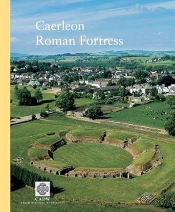
A third revised  edition of the guidebook for Caerleon, also written by Jeremy Knight,
was published Cadw: Welsh Historic Monuments in 2003. Here is the cover:
 
 
* * *


Saturday, November 9, 2013

South Shields Roman Fort


The Roman Fort in South Shields is located on the south side of the River Tyne, close to the river mouth, ca. ten km east of Newcastle. The Roman (or Latin) name of the fort is Arbeia. A short, but excellent guidebook about the place was published by the Tyne & Wear Museums a few years ago (ca. 2004). For some reason the name of the author is not mentioned anywhere.

The text is divided into three sections:

** Part one: The History of the Fort – 9 pages

** Part two: Excavation and Discovery – 4 pages

** Part three: Reconstructing Arbeia – 3 pages

The text is illustrated with several maps and photos. All illustrations are in colour except an old photo from 1875 which is in black-and-white. All illustrations are helpful and instructive.

Four maps show the development of the fort:

Map # 1 (around AD 160): the fort covered an area of 1.67 ha and was home to a unit consisting of 480 foot soldiers and 120 cavalry.

Map # 2 (around 208): the fort was extended to the south, increasing the size of the fort to 2.1 ha, and it functioned as a supply base for the campaigns of Emperor Septimius Severus in Scotland (208-211).

Map # 3 (AD 222-235): the fort functioned as a supply base. Seven granaries were added to the existing; new headquarters and barracks were built.

Map # 4 (the late third or early fourth century): the number of granaries was reduced and a larger area was given over to accommodation for the garrison.

During this phase a unit of bargemen from Tigris (numerus barcariorum Tigriensium) arrived. This is probably the reason for the Latin name of the fort, Arbeia, which means “the place of the Arabs.”

Today the most striking features of the fort are the full-scale reconstructions: the west gate, a barrack, and a part of a late-Roman courtyard house. These reconstructions are described in the text and shown with illustrations.

The local museum, which opened in 1953, consists of two galleries. Among the numerous objects presented in the book I will mention two:

(1) The tombstone of Regina, the wife and former slave of Barates. The caption to the photo of the tombstone adds the following details:

“She was from the tribe of the Catuvellauni, which was centred around what is now St Albans. Her husband was from the great desert city of Palmyra in Syria; his first language would have been Aramaic, similar to modern Hebrew, and he added a brief message of mourning in that language to the Latin text.”

(2) A sandstone inscription describing the installation of a water supply for the Fifth Cohort of Gauls under the governor of Lower Britain, Marius Valerianus, in AD 222. The caption to the photo of the inscription adds the following details:

“The first five lines are occupied by the names and titles of the emperor Alexander Severus. Following his murder, his memory was condemned across the Empire, and part of his name was erased on this inscription.”

South Shields Roman Fort is an interesting place. It is worth a visit. The guidebook about the site – published by Tyne & Wear Museums - is short, but excellent. Read it before you go. It will help you understand and appreciate what you see. Bring it with you, when you go. The maps will help you navigate the fort.

PS. Several other Roman sites in the north of England are worth a visit, including the following:

** Birdoswald – see Birdoswald Roman Fort (2001) as well as Birdoswald Roman Fort (2005)

** Chesters – see Chesters Roman Fort (1999)

** Corbridge – see Corbridge Roman Site (1989)

** Housesteads – see Housesteads Roman Fort (1999)


* * * 
 
Arbeia Society,
Arbeia: Roman Fort and Museum, South Shields,
Tyne & Wear Museums, published ca. 2004, 16 pages
 
* * *