Friday, November 8, 2013

Segedunum Roman Fort


Wallsend is one of several Roman forts built along or near Hadrian’s Wall in the north of England. This fort was built at the eastern end of the wall, as the modern name explains. The Romans called it Segedunum, which probably means something like “strong” or “victorious.” It is located in today’s Newcastle.

In the third and fourth centuries AD the garrison at Segedunum was the fourth cohort of Lingones, a mixed unit of 120 cavalry and 480 infantry.

The typical Roman fort is shaped like a playing card, i.e. a rectangle with round corners. The Romans had standard regulations for the orientation of a fort and for the different buildings inside it, but there was always room for local variations. No two forts are exactly alike.

Segedunum was built on the north bank of the river Tyne. The wall joined the fort at the western gate and continued from the south eastern corner to the water’s edge. Perhaps the end of the wall was marked by a statue of Emperor Hadrian.

In Segedunum you can see the foundations of several buildings: the military headquarters (principium), the commandant’s house (praetorium), a double granary (horreum), the hospital (valetudinarium) and some barracks. Recent investigations seem to indicate that the six barracks in the northern sector (praetentura) was allocated to the infantry, while the four barracks in the southern sector (retentura) was allocated to the riders and their horses. The northern barracks are partially hidden by a modern road (Buddle Street).

West of the fort there is a full-scale reconstruction of a short section of the wall. It is 5 m high on the front (facing north) and 3.5 m high on the back (facing south). This means there is a parapet of 1.5 m. The experts do not agree about the height of the wall. Perhaps it was higher. It is not known if there was a parapet, but many experts believe there was one, and this is why it was decided to build one here.

On the back of the wall the natural stones are covered with plaster in different ways to remind us that the Romans often covered the raw stones with plaster. Sometimes they would draw red horizontal and vertical lines on the white plaster. Viewed from a distance the wall would seem to be built by white rectangular blocks.

South of the fort there is a full-scale reconstruction of a Roman bath house. It is based on the impressive surviving remains of the bath house at Chesters, but has been laid out in mirror image in order to fit the space available for it here.

For more information about Chesters see my blog: Chesters Roman Fort.

Other Roman sites in the north of England include the following:


The modern reconstruction in Newcastle includes all the major rooms of a Roman bath house: the entrance room (vestibulum), the changing room (apodyterium), the cold room (frigidarium), the tepid room (tepidarium), the hot room (calidarium), the furnace (praefurnium), and the latrines (latrinae).

Segedunum Roman Fort is the subject of an excellent booklet written by W. B. Griffiths and published by Tyne & Wear Museums. The booklet is divided into three parts. The first part is called “History.”. The second part is called “Archaeology.” The third part is called “Present Day.”

The text is illustrated by a large number of photos, drawings and maps. All illustrations are in colour, except for a few old photos, which are in black-and-white. All illustrations are helpful and instructive.

The photos show us what is visible today. The drawings are modern reconstructions. They show us what a particular building (probably) looked like when it was new. The drawing on page 4 gives us an idea of how the fort may have looked in Roman times. The maps give us orientation: there is a map of Hadrian’s Wall on page 3; there is a map of the eastern end of the wall on page 5, and a map of the layout of the fort during the second century AD on page 13.

The first part of the booklet – “History” – is divided into several short sections, including the following:

* The building of Hadrian’s Wall
* Buildings within the fort
* Outside the fort
* After the Romans

The third part of the booklet – “Present Day” – is divided into several short sections, including the following:

* Museum
* Viewing tower
* Bath-house
* Hadrian’s Wall: the reconstruction

The local museum is housed in a new building east of the fort. It presents the history of the town from antiquity until today. The museum includes a 34 m high tower with an observation platform. The tower looks like the bridge on a ship. This is no coincidence, because the fort’s neighbour is the Swan Hunter Shipyard. From the observation platform you can have a bird’s eye view of the ancient Roman fort and the surrounding area.

The reconstructed bath-house is presented on pp. 52-54. The reconstruction of Hadrian’s Wall is presented on pp. 56-57.

W. B. Griffiths has written an excellent guidebook about this fort. Read the book, it is highly recommended; visit the site, if you can, it is a very interesting place.

* * *

W. B. Griffiths,
Segedunum: Roman Fort, Baths, & Museum,
Tyne & Wear Museums, Newcastle, 2000, 60 pages
PS. A second edition of this guidebook (with 76 pages) was published in 2008

* * *


Thursday, November 7, 2013

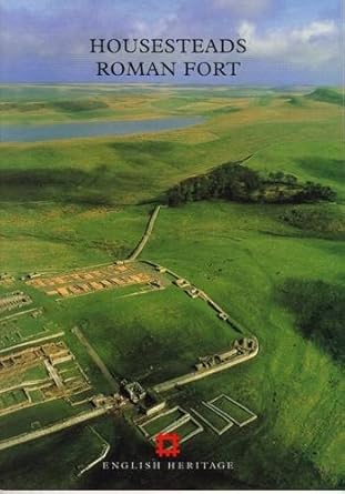
Housesteads Roman Fort


Housesteads Roman Fort is one of several forts built along Hadrian’s Wall in the north of England. The Roman (or Latin) name is Vercovicium. Today it is one of the most visited (and most photographed) forts along the wall, partly because it is quite well preserved, and partly because it is located on the top of a hill in a very picturesque landscape.

Hadrian’s Wall was a huge construction project which comprised several elements:

(1) The wall itself, running 80 Roman miles (118 km) from coast to coast.

(2) Milecastles with short and regular intervals. As the modern name says, the distance from one milecastle to the next was one Roman mile, i.e. 1.5 km.

(3) Watchtowers with short and regular intervals. Between two Milecastles there were two towers. The distance between the towers was around 500 meters.

(4) Fifteen forts along the wall.

(5) Additional forts in the area, south of the wall four, north of the wall three. Finally, there was one fort by the coast and on the south bank of the river Tyne: South Shields Roman Fort (Arbeia).

Construction began in AD 122 during Hadrian’s visit to the province. The work was (more or less) completed in six years, i.e. by AD 128.

[Read about Hadrian’s Wall in The Wall: Rome's Greatest Frontier.]

The typical Roman fort is shaped like a playing card, i.e. a rectangle with round corners. The Romans had standard regulations for the orientation of a fort and for the different buildings inside it, but there was always room for local variations. No two forts are exactly alike.

The standard regulations say a fort must follow a north-south line, so that the short ends face north and south, while the long sides face east and west. But this fort has been turned 90 degrees, so that it follows an east-west line. When you look at the place, it is easy to understand why. This east-west orientation is demanded by the local landscape.

In Housesteads you can see the foundations of the four major gates. Inside the fort you can see the foundations of several buildings: the commandant’s house (praetorium), the military headquarters (principium), the hospital (valetudinarium), two granaries (horrea), two barracks, and (in the south-west corner) the latrines.

South of the fort there was a small village (vicus) with small houses (canabae). You can still see the foundations of six houses below the southern gate, but in Roman times there were more than six houses here. The civilian population provided goods and services which the soldiers could not produce or get hold of by themselves.

This ancient site is the subject of an excellent booklet written by J. G. Crow and published by English Heritage. The booklet is divided into four parts. The first part presents a tour of the fort, including the local museum. The second part gives information about the surrounding area, including the local village. The third part gives information about northern Britain under the Romans, including the construction of Hadrian’s Wall. The last part presents the history of the fort.

The text is illustrated by a large number of photos, drawings and maps. Unfortunately, all illustrations (except the pictures on the front cover and the back cover) are in black-and-white. Fortunately, all illustrations are helpful and instructive.

The photos show the current situation. They show what is visible today. The drawings are modern reconstructions. They show what a particular building (probably) looked like when it was new. A case in point is the colour drawing printed on the back cover which shows the interior courtyard of the commandant’s house. The maps give us orientation: there is a map of the fort and the surrounding area on pp. 30-31; there is a map of the fort itself on pp. 26-27. Other maps show the layout of particular buildings: we have the headquarters on page 20, and the hospital on page 22.

The first part of the booklet – “A Tour of the Fort” – is divided into several short sections, including the following:

* The south gate
* The east gate

* The north gate
* The west gate

* The hospital
* The headquarters

The local museum is located in a small modern building south west of the fort. Here you can see some of the objects found inside the fort and in the surrounding area.

My favourite is a small relief of three hooded deities (Genii Cucullati) found in a shrine in the local village and datable to around AD 230. They wear the hooded capes (byrrus Britannicus), which were famous as exports from Britain. There is a picture of this relief on page 3. Even as a small-size photo in black-and-white, it is very vivid.

Housesteads Roman Fort is an important and interesting historical monument. It is worth a visit. J. G. Crow has written an excellent guidebook about this site. Read it before you go there. It will help you understand and appreciate what you see. Bring it with you when you go there. The maps will help you navigate the fort and the surrounding area.

PS. Be sure to set aside some time to take a walk along the wall towards the east and/or the west to get a feel for the landscape and the local conditions in this northern corner of the Roman Empire.

* * *

J. G. Crow,
Housesteads Roman Fort,
English Heritage, London, first published 1989,
Reprinted 1992, 1995, and 1998, 52 pages

* * *
 
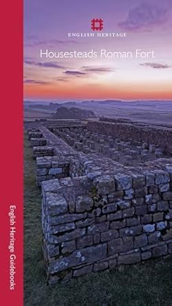
A new guidebook for Housesteads Roman Fort, also written by J. G. Crow,
was published by English Heritage in 2012. Here is the cover:
 
 
* * *


Wednesday, November 6, 2013

Corbridge Roman Site


Corbridge Roman Site is one of several forts built along or near Hadrian’s Wall in the north of England. The ancient (or Latin) name is Coriosopitum. It is located ten km east of Chesters Roman Fort and five km south of the wall.

As early as AD 80, long before Hadrian’s Wall, the Romans built a fort here, but around AD 160 it was turned into a civilian town which covered an area of twelve hectares. Two main roads crossed each other: Stanegate ran west towards Carlisle, while Dere Street ran north towards Scotland and south to London.

[For more information about this topic, see Roman Roads in Britain.]

Stanegate crosses the archaeological zone from east to west. North of the street you can see the foundations of two granaries (horrea) and a fountain house. There is also a large area (87 x 93 m) which is known as “Site 11.” The construction was never completed here. The archaeologists do not know what the purpose of this area was. Perhaps the beginning of a new forum?

South of the street you can see the foundations of four temples, but it is not so easy to see the outline of these monuments. In the south west corner of the archaeological zone you can see the foundations of the military headquarters (principium). A flight of stairs leads to an underground room where the strong box (aerarium) was kept.

This Roman site is the subject of an excellent booklet written by J. N. Dore and published by English Heritage. The booklet is divided into three parts. The first part presents a tour of the site. The second part presents the history of the site. The last part presents the local museum.

The text is illustrated by photos, drawings and maps. Unfortunately, all illustrations (except the pictures on the front cover and the back cover) are in black-and-white. Fortunately, all illustrations are helpful and instructive.

The photos show the current situation. They show what is visible today. The drawings are modern reconstructions which show what a particular building (probably) looked like when it was new. On page 9 we have a drawing of the fountain house. The maps give us orientation: there is a map of the site and the surrounding area on page 19; and a map of the site on pp. 20-21.

The first part of the booklet – a tour of the site – is divided into several short sections, including the following:

* The main street
* The granaries

* The fountain house
* The east compound

* The west compound
* Site 11

In the local museum, which dates from 1983, you can see some of the objects found on the site or in the surrounding area. One remarkable object is a tombstone for a man called Barathes, who “lived to be 68 years old.” The inscription on the stone says “VIXIT LXVIII AN.” The last two letters (AN) stand for the word “ANNOS.”

Barathes was a silk trader from the Syrian town Palmyra, in the south eastern corner of the Roman Empire. Silk from China entered the Roman Empire via his home town. He travelled to Britannia, the north western corner of the empire. In the south of England, home of the Catuvellauni tribe, he bought a female slave called Regina. He liberated her and married her, and together they moved to the north of England. When she died, only 30 years old, he set up a beautiful tombstone in memory of her. Today this stone is placed in the small museum next to South Shields Roman Fort (Arbeia) in Newcastle.

Another tombstone in the Corbridge museum is for a girl called Vellibia - with the nickname Ertola - who died before she was five years old. Her father Sudrenus set up the stone in memory of her. Here is an English translation of the Latin text:

“Sudrenus [set up this tombstone] to Ertola properly called Vellibia [who] lived most happily for four years and 60 days.”

Source: Roman Inscriptions of Britain, 1965, # 1181.

The relief on the tombstone shows a child holding a ball as if in play.

Corbridge Roman Site is an important and interesting historical monument. It is worth a visit. J. N. Dore has written an excellent guidebook about this site. Read it before you go there. It will help you understand and appreciate what you see. Bring it with you when you go there. The maps will help you navigate the ancient site.

* * *

J. N. Dore,
Corbridge Roman Site,
English Heritage, London,
First published 1989, reprinted 1991, 1993, 1995, 1997, 1998, 39 pages

* * *


Tuesday, November 5, 2013

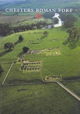
Chesters Roman Fort


Chesters Roman Fort is one of several forts built along Hadrian’s Wall in the north of England. This site, which lies about ten km west of Housesteads Roman Fort, should not be confused with Chester further south. The Roman name for Chesters is Cilurnum. The Roman name for Chester is Deva.

The fort was built to house a cavalry unit named “Augusta” because of its valour: “ala Augusta ob virtutem appellata.” But towards the end of the second century AD it was replaced by another unit whose members originally came from Asturia: “ala II Asturum.”

The typical Roman fort is shaped like a playing card, i.e. a rectangle with round corners. The Romans had standard regulations for the orientation of a fort and for the different buildings inside it, but there was always room for local variations. No two forts are exactly alike.

This fort is built astride the wall. Three of the four major gates gave access to the area north of the wall, while the south gate gave access the area south of the wall. East of the fort we have the river North Tyne. In Roman times the wall crossed the river here. Between the fort and the river we have the bath house.

In Chesters you can see the foundations of the four major gates. You can also see the foundation of the minor gate on the east side, known as Porta Quintana Dextra. Inside the fort you can see the foundations of several buildings: the military headquarters (principium), the commandant’s house (praetorium), and some barracks.

The Bath House, located between the fort and the river, is one of the best preserved Roman buildings in England, with walls surviving to an average height of two meters. You can identify all the major rooms of a Roman bath house here: entrance room (vestibulum), changing room (apodyterium), the cold room (frigidarium), the tepid room (tepidarium), the hot room (calidarium), the furnace (praefurnium), and the latrines (latrinae).

In Wallsend Roman Fort – ancient Segedunum – in present-day Newcastle, archaeologists have built a full-scale reconstruction of a Roman bath house. The reconstruction is based on the remains of the bath house at Chesters, but has been laid out in mirror image in order to fit the space available for it.

On the other side of the river (on the eastern bank) we have the remains of the bridge which carried the wall across the river. The Romans built at least two bridges here. The first, from ca. AD 125, had nine low arches, while the second, from AD 209, had four grand arches and a tower at both ends.

In order to visit the abutment of the bridge on the eastern river bank you have to leave the fort, walk back to the car park, follow the B6318 to Chollerford, cross the river on the modern bridge, and then follow the footpath along the river to the Roman bridge. It is quite a walk, just to get to the other side of the river!

This ancient site is the subject of an excellent booklet written by J. S. Johnson and published by English Heritage. The booklet is divided into four parts. The first part presents a tour of the fort, including the local museum. The second part gives information about the bridge. The third part gives information about the Romans in the North of England, including the construction of Hadrian’s Wall. The last part presents the history of the fort.

The text is illustrated by a large number of photos, drawings and maps. Unfortunately, all illustrations (except the pictures on the front cover and the back cover) are in black-and-white. Fortunately, all illustrations are helpful and instructive.

The photos show the current situation. They show what is visible today. The drawings are modern reconstructions. They show what a particular building (probably) looked like when it was new. The drawing on page 13 gives a general impression of how the bath house may have looked in Roman times. The maps give us orientation: there is a map of the fort and the surrounding area on pp. 2-3; there is a map of the fort itself on page 6, and a floor plan of the bath house on page 12.

The first part of the booklet – “A Tour of the Fort and Bath House” – is divided into several short sections, including the following:

* The north gate
* The west gate

* The southern part of the fort
* The barracks

* The bath house
* The civilian settlement south of the fort

The local museum is located in a small building north of the fort, next to the modern car park. Here you can see some of the objects found along Hadrian’s Wall. The museum was set up around 1900, and the presentation has not changed much since then. The style is Victorian, i.e. a large number of objects in a small room.

Chesters Roman Fort is an important and interesting historical monument. It is worth a visit. J. S. Johnson has written an excellent guidebook about this site. Read it before you go there. It will help you understand and appreciate what you see. Bring it with you when you go there. The maps will help you navigate the fort and the surrounding area.

* * *
 
J. S. Johnson,
Chesters Roman Fort,
English Heritage, London,
First published 1990, reprinted 1995, 1998, 1999, 44 pages

* * *
 
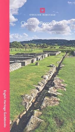
A new guidebook for Chesters Roman Fort, written by Nick Hodgson, 
was published by English Heritage in 2011. Here is the cover:
 
 
* * *


Monday, November 4, 2013

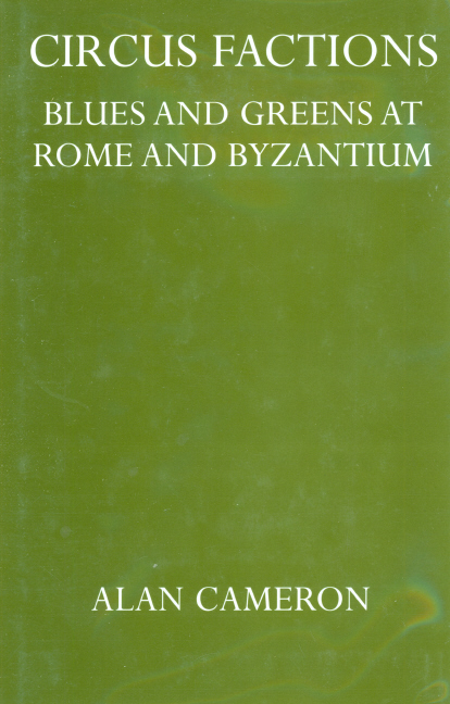
Circus Factions: Blues and Greens


click to close window


Alan Cameron (born 1938) is a classical scholar from the UK. In the late 1970s he moved to the US where he was Professor of Latin Language and Literature at Columbia University of New York until his retirement in 2008. He is the author of several books about the history of the ancient world, including the following:


** Porphyrius the Charioteer (1973, reprinted 1999)

** Circus Factions: Blues and Greens at Rome and Constantinople (1976, reprinted 1999)

** Barbarians and Politics at the Court of Arcadius (1993)

** The Last Pagans of Rome (hardcover 2011, paperback 2013)

Circus Factions is a sequel to Porphyrius. Like Porphyrius, it is an academic work: most quotations are given in the original language – Greek, Latin, and French – and most of them are not translated into English. Several sections are given to questions of terminology. They are, as Cameron says, “not always easy reading, but inescapably relevant.” The author assumes the reader has a basic knowledge of Roman and Byzantine history. Therefore this book is not recommended for the beginner.

If, on the other hand, you are already familiar with the history of the ancient world and you wish to learn more, then this could be the right book for you. When you read it, you will get a chance to see a meticulous and thorough scholar at work.

Cameron knows his topic very well (the ancient evidence and the relevant modern scholarship). He has no mercy for modern scholars whose works are based on wishful thinking. In the preface, a volume published by a French scholar in 1968 is described as “a book whose spectacular marriage of traditional falsehood with original fantasy has put it beyond the reach of ordinary criticism.”

When a key statement from this book is presented on page 134, Cameron simply adds a footnote where he says: “Detailed refutation of each item will not be necessary; it will be enough to point out that there is not one single scrap of ancient evidence for any of these attributions.”

The term “circus faction” is a modern construction. It is not used in any ancient text that we have, as Cameron points out on page 14, but he decided to use it anyway, because it is convenient and practical.

There were four factions in the world of ancient Rome and Constantinople, each of them identified by a colour: Reds, Whites, Blues and Greens. Of the four factions, the Blues and the Greens were relatively large, while the Reds and the Whites were relatively small. As for the two large factions, it seems the Greens were more numerous than the Blues.

What about the emperors? We know the preference of several emperors: Caligula (also known as Gajus), Nero, Domitian, Lucius Verus, Commodus, Elagabalus, and Theodosius II all supported the Greens; Vitellius, Caracalla, and Justinian I supported the Blues; while Anastasius supported the Reds (pp. 54 and 71).

What about the charioteers? We have the names of several drivers and some information about their careers, mainly based on inscriptions on tombstones and statue bases (page 11, note 6):

* Diocles won 1,462 times
* Flavius Scorpus won 2,048 times
* Liber won 3,000 times
* Pompeius Muclosus won 3,559 times

The famous charioteer Publius Aelius Gutta Calpurnianus (who won 1,227 times) is mentioned as "Gutta" on page 202 (note 4).

Sometimes, if a driver had a long and successful career, he would change from one colour to another, but we do not know how often this happened. Regarding this issue, Cameron says, “the successful charioteer (like the successful footballer today) seems to have been … free to change colours … if the offers were forthcoming and he himself was willing.”

For information about Porphyrius, perhaps the most popular driver of them all, go to Porphyrius the Charioteer.

Circus Factions is not so much about the drivers and the races; it is more about the fans of the drivers and the role they played in ancient history (in the circus and outside). The book is divided into two parts and twelve chapters. The first part of the book (chapters I-VI) is devoted to a point by point examination (and rebuttal) of the previous scholarship on the topic, referred to as the traditional or conventional view.

According to the traditional view, the Blues were upper class, while the Greens were lower class, i.e. there was a social and economic conflict between them (chapter IV). According to the traditional view, the Blues were orthodox (Chalcedonians), while the Greens were Monophysites, i.e. there was a religious conflict between them (chapter VI).

Cameron insists, again and again, that the traditional or conventional point of view is not true, for two reasons: (a) it is not supported by any part of the ancient evidence that we have; (b) it is contradicted by all the ancient evidence that we have.

In the second part of the book (chapters VII-XII) Cameron presents his own view of the circus factions and the role that they played in the history of the Roman and the Byzantine Empires. This view is firmly based on the ancient evidence.

The first part is mostly destructive, as you can see from the above, while the second part is more constructive. In his preface, Cameron says many readers “may prefer to begin with the positive rather than the negative.”

What about illustrations? There is only one illustration in this book: a picture of a circus programme from the sixth century, discovered in the Egyptian town Oxyrhynchus, is printed on the frontispiece. It is mentioned in the text on pp. 213-214. Today this document is available online: the official reference is Ox.Pap. vol. XXXIV # 2707.

A few ancient images are mentioned in the text, but none of them is shown in the book. One example appears on page 62, where Cameron mentions the famous opus sectile wall mosaic from the basilica of Junius Annius Bassus (consul 331):
 
“On each side behind the consul standing in his chariot are two horsemen in appropriately coloured jackets, Red and Blue to the left, Green and White to the right.”

[Today this polychrome item is placed in Palazzo Massimo alle Terme in Rome. Several pictures of the mosaic are available online (Wikimedia).]

http://upload.wikimedia.org/wikipedia/commons/thumb/4/4b/Pannelli_di_giunio_basso_03.1.jpg/640px-Pannelli_di_giunio_basso_03.1.jpg

This picture (borrowed from Wikimedia) shows the famous opus sectile
wall mosaic from the basilica of Junius Bassus (consul 331).

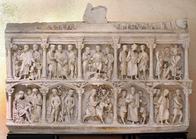
[Junius Bassus (consul 331) is the father of Junius Bassus (praefectus urbi 359), whose sarcophagus was discovered in 1597. For more information about this magnificent archaeological item, see The Iconography of the Sarcophagus of Junius Bassus by Elizabeth Struthers Malbon (1992).]


http://upload.wikimedia.org/wikipedia/commons/thumb/1/1e/Sarcophagus_of_Junius_Bassus_-_Cast_in_Rome.jpg/640px-Sarcophagus_of_Junius_Bassus_-_Cast_in_Rome.jpg

This picture (borrowed from Wikimedia) shows the famous sarcophagus of
Junius Bassus (praefectus urbi 359).

The circus factions were involved in several violent episodes. The most well-known is the Nika Revolt, which took place in Constantinople in 532. This episode is covered in the text (pp. 277-280), while additional evidence is presented in appendix C (pp. 318-333).

Cameron’s book is based on a wide range of sources, including curse tablets, which are mentioned several times (pp. 56, 61-62, 194, and 200). A footnote refers to a book that was published in 1904: Defixionum Tabellae, written in Latin by the French scholar Auguste Audollent (today this huge volume is available online). A recent work on this topic is Curse Tablets and Binding Spells from the Ancient World edited by John Gager (1999).

As stated above, Circus Factions is an academic work. It is not an easy read. But if you persevere, you will learn a lot about an interesting and important aspect of the Roman and Byzantine Empires.

PS. The following works appeared after Cameron’s book was published: Roman Circuses: Arenas for Chariot Racing by John Humphrey (new edition, 1992); Chariot Racing in the Roman Empire by Fik Meijer (2010); and Life, Death, and Entertainment in the Roman Empire edited by David Potter and David Mattingly (second edition, 2010).

* * *
 
Alan Cameron,
Circus Factions: Blues and Greens at Rome and Constantinople,
Oxford University Press 1976, reprinted by Sandpiper Books 1999, 364 pages
 
* * *